This is a guest post from Liz. She sometimes contributes to All Over Albany, and she blogs at The Good Eater. Thanks, Liz!
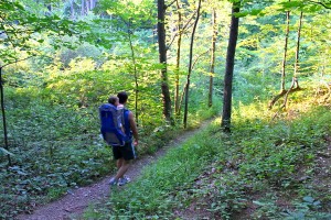
When I go for a walk along the Niskayuna Trails with my son and husband, chances are we’ll see a deer before we see another person.
That’s not a bad thing, but we’ve been hiking there for almost two years and it’s getting a little lonely.
The trails are located behind Lock 7 in Niskayuna (a fun stop on its own), but unless you’re looking for trail markers, you might miss the paths leading into the woods.
Along the Mohawk-Hudson bike-hike trail (between Blatnick Park and the beginning of the road to Lock 7) there are at least 4 different trail entrances. Each has its own appeal: a hike up and down a gorge, a high atop view of the Mohawk River, a babbling brook to explore and many well-labeled trees, which is a big plus when you’re looking for family fun.
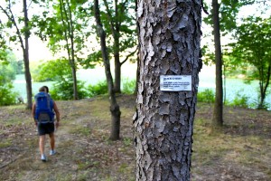
Our little hikes become educational: Sugar Maple, Apple and Black Cherry trees (and many others) are all marked with descriptions, blueberries and blackberry bushes are everywhere and the wildlife there is well, truly wild.
We see hawks on almost every trek and deer are a constant too. Toads and harmless snakes cross our path while chipmunks climb the trees beside us. Fox also made their existence known against the white snow of two winters past.
But whatever the season, it’s a great spot to escape to – even if it’s for a short walk between nap times.
Getting There:
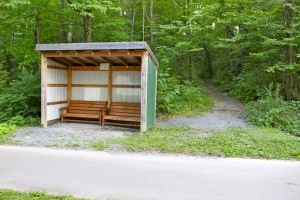
The easiest way to access the trails is to park in the lot at Lock 7 and then walk southwest to the bike-hike path, take a right onto the paved path and you’ll come across a sheltered bench. That’s just one of the trailheads that will get you on the paths.
Another option is to drive down to the end of Whitmeyer Drive (off of River Road) in Niskayuna. On your right will be another trailhead; this one is labeled “Nature Preserve.â€
The Trails:
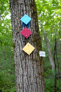
The trails sit on over 100 acres of town and state land and are color coded: Â red (east-west), blue (north-south), yellow (loop), white (connector).
A map of the trails can be found on the JFBTrails wiki page.
The newest trails in the system are known as the John F. Brown trails. They’re named after the man who was passionate about the land and worked hard to create many of the trails there today.
A list of all of the trails can be found through this page on the JFBTrails page.
Good to Know:
It’s really dry (like, cracks in the dirt) on the trails right now, so mud certainly isn’t an issue. And for the last few months we haven’t noticed one tick (though beware; March-May of this year there were a lot).
Like you would for any walk in the woods, proper footwear and clothes to avoid tick bites is certainly suggested.
While most of the trails are family friendly, if you have a small child who likes to bolt, it’d be best to stay on the trails closest to the bike-hike path that are on lower ground.
Get Involved:
FONT, the Friends of Niskayuna Trails is a group that meets on most Saturdays to do trail clean up. They also appreciate help with signage. If you’re interested in helping out you can contact them through their Facebook page.

Matt
You have stumbled upon Mohawk River State Park (no, really), which was formerly the Schenectady Museum Nature Preserve until the state bought it some years ago. The state took down all the trail signs, and then, without any funding allocated, has put zero resources into state parkifying the place, not even putting up a sign. All the land from River Rd. and the sewage plant over to Lock 7 is in this park.
Matt
Yep, I’m not hallucinating:
http://www.northcountrygazette.org/articles/042006SchenectadyPark.html
Matt
Ah, thanks to the Google: another nice article:
http://blog.timesunion.com/outdoors/a-romp-through-an-unidentified-state-park/4257/
Jodi
Oh, what a fantastic new find! We usually frequent the Lisha Kill preserve in Niskayuna when we’re in that area, but this sounds fantastic! What a shame that they haven’t done anything with that land to make into a user-friendly state park.
Liz
Matt, thanks for clarifying – the “state land” is the Mohawk River State Park. The whole history/ownership is so muddy that I decided to leave it out. I do wish they put more resources into the land – and yes, at least a sign would be helpful. (Why on earth would they take down trail signs after the purchase? Seems so strange.)
The folks of FONT (full discretion – I’m a member) do our best to maintain what we can of the trails. Do you use the land often? Thanks for the comment and links.
Jodi, Lisha Kill is great! These trails certainly aren’t as well maintained, but it’s worth a trip down the road 🙂
Matt
Liz – not much, but we’re about to buy a house between Lisha Kill and The Emperor’s New State Park, so we will likely be more regular users and I hope can contribute some time to FONT. Do you have a relationship with friends of the Mohawk Trail? I expect there’s some crossover…email Katie for my email address (I don’t want to post it in public comments as an anti-spam thing). I’m also on the FONT FB page likes.
Katie
@ Matt & Liz–so excited that there’s a little community connection thing going on in the comments, & thanks for the extra info!
@ Jodi–I have to explore this stuff, too. I haven’t done much off the paved paths
mark
Hi all,
I was very involved in this place when it belonged to the Museum from about ’89 until it became a park – I was there when Gov Pataki dedicated it at the little parking lot! I’m still a frequent visitor with family and friends. I have most of the records and would like to keep connected with any people who are looking to improve the place. When I left we were done with the tree labels and interpretive displays (signboards), had built the pavilion and were starting to work with local teachers to run educational programs. I see these posts are a year old, if you’re still interested please e-mail me!
Katie
@mark, I’m forwarding the comment and your info to Liz, who wrote the guest post, and if I come up with someone who else who might be collaborating, I’ll let you know. Thanks for getting in touch.